

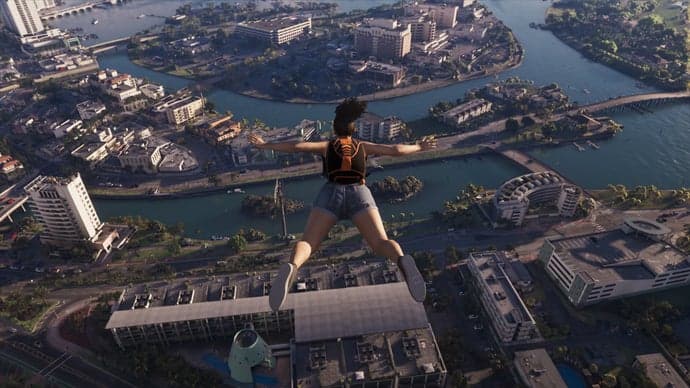
GTA VI Map Built in Cities: Skylines II and Compared to Game Trailers
The Breakdown
A modder working in Cities: Skylines II has built a scaled recreation of the Leonida map, stitching together confirmed locations from both GTA 6 trailers into a functioning city sim layout. This isn't the first fan attempt to map Vice City's return, but it's one of the most methodical, using landmark placement, coastline curvature, and road geometry pulled directly from trailer frame analysis rather than guesswork.
The build reportedly nails several key structural elements that the community has been tracking since Trailer 1 dropped:
- The downtown Vice City peninsula with its dense high-rise cluster
- The bridge and causeway system connecting the mainland to the islands
- The swamp region to the north, matching the Everglades-style biome seen in rural trailer shots
- Highway interchanges that mirror the elevated freeway shots from both trailers
The creator cross referenced specific camera angles from the trailers, matching building silhouettes and shoreline angles to lock in proportions. Cities: Skylines II's terrain tools allow for fairly precise elevation and water placement, which is why this recreation reads more like a legitimate scale model than the block-out fan maps that circulated after Trailer 1.
Rockstar has not confirmed any final map dimensions, road network specifics, or district boundaries. Everything here remains fan reconstruction based on visual evidence, not leaked internal assets. That distinction matters, because it means every conclusion drawn from this build is still subject to revision once official gameplay data lands.
That said, the timing is notable. This recreation surfaces right as anticipation builds toward the Extended Look premiering on Netflix and YouTube August 27, which is expected to include the first substantial gameplay footage. If Rockstar shows more of the map in motion during that premiere, this fan build will either get validated in impressive detail or exposed as an educated guess. Either way, it's a useful reference point heading into that reveal.
Tactical Analysis
Here's my take: fan map reconstructions like this are more than internet curiosities. They're free scouting reports, and smart players should treat them that way.
If this Cities: Skylines II build holds up against official gameplay in the Extended Look, it tells us something important about how Rockstar has structured Leonida's traversal loop. A downtown peninsula connected by bridges to swamp terrain and highway interchanges means your early game vehicle choices are going to matter more than they did in GTA 5's more uniform sprawl. You're not just picking a fast car, you're picking a car that handles bridge chokepoints, swamp mud, and dense urban blocks without getting stuck in a mode mismatch.
Think about what that means for police chases. Bridges are natural chokepoints. If Vice City's downtown connects to the mainland through a handful of causeways, that's where the AI police response system is going to concentrate roadblocks. We already know from the leaked gameplay features report that Rockstar is building a more reactive AI police system this time around. A constrained map layout with limited bridge access plays directly into that. Expect early strategies to revolve around memorizing which bridges have escape routes and which ones are dead end traps once a chase gets to three stars or higher.
The swamp biome also has bigger implications than people are giving it credit for. If it's a legitimate traversal zone and not just scenery, that opens the door for boat-based smuggling routes, off-road vehicle specialization, and possibly wildlife encounter systems that punish players who bring the wrong vehicle to the wrong biome. GTA 5's countryside was mostly cosmetic outside a few missions. If Leonida's swamp is structurally central to the map the way this fan build suggests, it could become a legitimate business zone for players once GTA Online launches its property systems, similar to how we're already tracking real estate and laundering mechanics in the property business guide.
The highway interchange detail is the part I'd watch closest. Elevated freeways historically become PvP hotspots in GTA Online because they offer long sightlines for ramming and shooting while still connecting multiple map zones quickly. If this recreation's freeway layout is accurate, high-tier players are going to be fighting over highway control points from week one of online launch, the same way certain Los Santos overpasses became contested territory in GTA Online's economy runs.
I'd also flag this for anyone tracking mission structure. The